
My rating system
It's not very scientific, but just one method to rate these hikes.
These ratings are suitable for anyone with average fitness.
| Difficulty | Distance | Terrain change |
|---|---|---|
| Easy | 0.0 to 2.0 miles | Little change |
| Moderate | 1.0 to 4.0 miles | Some change |
| Difficult | 1.0 and over | Steep terrain |
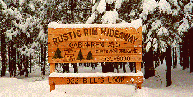
We can give you the specifics on any one of theses hikes, if you are interested in a cabin to rent!
By all means, this is not a complete list, but merely a sampling!
All distances are estimates only!
Obtain an Apache-Sitegreaves National Forest Map and a Tonto National Forest Map from a ranger station, Wide World Of Maps or from our local country businesses. All hikes near Forest Lakes can be found on these two forest maps. Consult the index contained upon the forest maps to determine any topographic maps needed.
Difficulty: Easy to Moderate; 1.5 miles to ~ miles (3 to ~ miles round trip).
Out the back door of your cabin to the Forest Road 99 intersection.
From the intersection, go north 0.1 - 0.2 mile to the obvious boulder and trail on the right side.
Follow the jeep trail east and follow the blue markings, until the jeep trail fades to a foot trail.
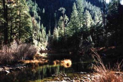
The foot trail drops into Smith Canyon and follow it as far as you can stand, then double back.
Difficulty: Easy to Moderate; 0.5 mile to 3 miles (1 to 6 miles round trip).
West of Forest Lakes 7 miles to Forest Road 300.
Once on Forest Road 300, park at any of the 5 trailheads (Willow Springs Trailhead, Rim Campground Trailhead, Military Sinkhole Trailhead, Rim Vista Trailhead, and Woods Canyon Vista Trailhead).
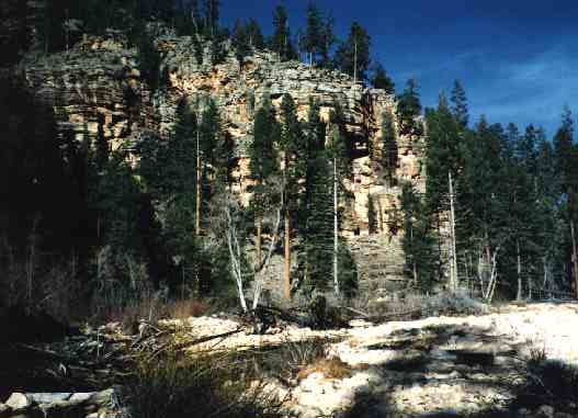
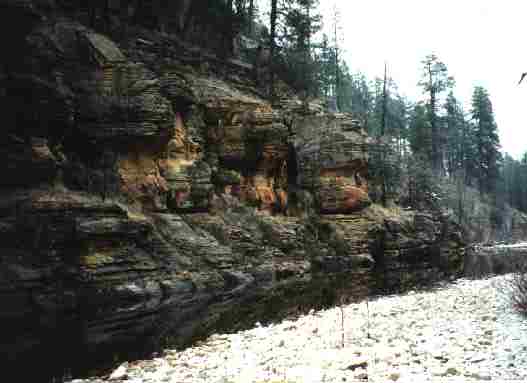
Follow the Rim Vista trail between any of the trailheads for an awesome view of the Tonto Plateau.
Option 1: (South side of Lake to Chevelon Creek)
Difficulty: Difficult; 1.5 miles (3 miles round trip) with steep downhill and up.
Vehicle advisory: Last stretch not suitable in all weather.
West of Forest Lakes 1 mile to Forest Road 237.
North on Forest Road 237 five miles until it dead-ends.
Follow the old jeep trail until the obvious saddle, then veer right down the wash for 30 yards, and follow the cairns north to the bottom of Chevelon Creek.
Water sloggers are recommended for the frequent creek crossings.
Option 2: (West side of Chevelon Lake)
Difficulty: Easy; 0.5 miles (1 mile round trip) on traversing trail.
Vehicle advisory: Low clearance vehicles not recommended along last stretch.
West of Forest Lakes on Highway 260 for 7 miles to Forest Road 300.
Northwest on Forest Road 300 for 3 miles of pavement and 4 more miles of gravel road to Forest Road 169.
Northeast on Forest Road 169 for 5 - 6 miles to Forest Road 119 (telephone ridge road).
Southeast on Forest Road 119 for 1.5 - 2 miles then Northeast on Forest Road 180 for 4 miles to trailhead.
Follow the traversing trail north/northeast to the West side of Chevlon Canyon Lake, about 0.5 miles.
Option 3: (West side of Chevelon Lake to Dam)
Difficulty: Moderate; 1.5 miles (3 miles round trip) on old dam road.
Vehicle advisory: Low clearance vehicles not recommended along last stretch.
West of Forest Lakes on Highway 260 for 7 miles to Forest Road 300.
Northwest on Forest Road 300 for 3 miles of pavement and 4 more miles of gravel road to Forest Road 169.
Northeast on Forest Road 169 for 9 -11 miles to Forest Road 169B.
East/Northeast on Forest Road 169B to Chevelon Canyon Lake Campground.
Park at the campground, and hike the old dam road to the Chevelon Canyon Lake Dam, about 1.5 miles.
Option 4: (East side of Chevelon Lake)
Difficulty: Difficult; 1.0 mile (2 miles round trip) with steep downhill and up.
Vehicle advisory: Low clearance vehicles not recommended along last stretch.
Take Forest Road 99 North of Forest Lakes 3 miles to Forest Road 170 (Wagon Draw road).
West (then quickly North) on Forest Road 170 six miles to Forest Road 90.
Northwest/North on Forest Road 90 for 4 miles to Weimer point.
Follow the trail to the Chevelon Canyon Lake, about 1.0 miles.
Difficulty: Moderate; 2 miles (4 miles round trip) rocky trail.
West of Forest Lakes 15 miles to Christopher Creek.
Across from the Chevron Gas Station in Christopher Creek is Forest Road 284.
North on Forest Road 284 for 1.5 -2 miles until it ends.
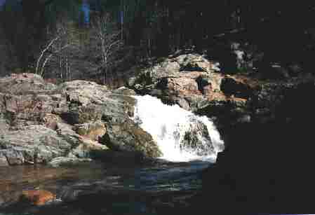
Cross the creek (may need water sloggers to cross) and follow the trail north/northeast 2 miles to See Spring.
Difficulty: Moderate to Difficult; 4 miles (8 miles round trip) rocky trail.
My good friend's favorite Sunday workout!
West of Forest Lakes 20 miles to Tonto Creek (Fish Hatchery) Turnoff (just east of Kohl's Ranch).
North on the Fish Hatchery Road 1 mile to the first crossing and Horton Creek Campground.
Park at the Trailhead parking on the west side of the crossing.
Hike back across the Tonto Creek Bridge towards the Horton Creek Campground.
From the Horton Creek Campground entrance, follow the descent into Horton Creek, and cross (May be dry and underground at this point, or it may be flowing heavily). Once on the north side of Horton Creek, follow the obvious trail for 4 miles to Horton Spring. The creek will appear above ground about a quarter mile up if the crossing was dry.
Be wary of the proliferous poison ivy along Horton Creek and the trail!!!